Drones and Underground Construction: How Sonoran Desert Institute Explores Aerial Mapping for Subsurface Planning
- Construction
Robert Desauza
- 0
- 11 minutes read
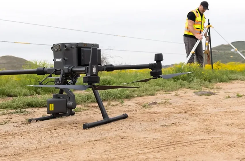
Underground construction, whether it involves tunneling, pipeline installation, or utility routing, requires detailed planning and accurate data to avoid costly mistakes. Traditionally, engineers and survey teams relied on ground-level methods that were time-consuming and sometimes limited in scope. Sonoran Desert Institute (SDI), accredited by the Distance Education Accrediting Commission (DEAC), recognizes that drones are improving the way underground projects are visualized and executed. These aerial tools collect detailed surface data that directly supports the subsurface design, helping teams better anticipate challenges and streamline execution.
By integrating drone technology with advanced mapping software, project teams can generate high-resolution topographic models and 3D visualizations of the terrain. These models allow for more accurate planning of entry points, excavation paths and equipment staging, significantly reducing the likelihood of errors during construction. Drone data can be updated in real time, enabling continuous monitoring of project progress and environmental conditions. This dynamic approach not only enhances safety and efficiency but also empowers engineers to make data-driven decisions throughout the project’s lifecycle.
Drones Supporting Subsurface Planning
While drones operate in the air, their data has a significant impact on what happens beneath the ground. Equipped with photogrammetry and Light Detection and Ranging (LiDAR) capabilities, drones gather detailed 3D imagery and topographical data. This information helps teams plan underground structures like tunnels and utility corridors with pinpoint accuracy. Drones assist engineers in identifying optimal entry and exit points, monitoring elevation changes, and preventing interference with existing underground systems.
The data captured through drone flights can be layered onto architectural plans, improving communication between designers, engineers and contractors working above and below the surface. This integration creates a unified visual reference that enhances collaboration and minimizes the risk of design discrepancies. Teams can quickly identify conflicts between proposed underground routes and existing surface features, allowing for proactive adjustments.
Drone-generated imagery reveals terrain complexities early in the planning phase, supporting more accurate cost estimates and timeline projections. Sharing real-time visual updates also keeps stakeholders informed, fostering transparency and faster decision-making throughout the construction process.
Creating Geospatial Overlays for Accurate Alignment
One of the key advantages drones bring to underground construction is the creation of geospatial overlays. These overlays merge drone-collected surface imagery with CAD files and utility schematics to deliver an integrated 3D visual model of the job site. With these models, engineers can:
- Align tunnel routes with surface features
- Plan excavations that avoid known hazards
- Identify areas of terrain instability or slope inconsistencies
This data-driven approach minimizes guesswork that often leads to costly rework or scheduling delays. It also helps crews stay aligned with regulatory standards and environmental safety protocols.
Preventing Conflicts in Tunneling and Pipe Installation
Subsurface planning is incredibly precise work because misalignments of even a few inches can lead to major construction issues. Drones help construction teams avoid such problems by mapping existing infrastructure, natural terrain features, and access paths. It allows designers to accurately position tunnels, boring paths, and pipe systems in coordination with the surface layout.
In urban areas, where underground space is often congested with utilities and older infrastructure, drone-generated models help visualize how new installations can be routed safely. They also assist in determining ideal launch and exit points for Tunnel Boring Machines (TBMs) based on slope, space availability, and surrounding structures.
Surface Risk Detection Before Excavation
Drones also play a role in pre-construction risk management. By capturing high-resolution images and elevation models, they help teams identify terrain risks such as potential sinkholes, erosion-prone zones or unstable slopes. These issues might be invisible at ground level but show up clearly in aerial scans.
Drone data also supports geological analysis by providing updated visuals that can be cross-referenced with soil testing and environmental assessments. In combination with ground-penetrating radar, drone scans help verify the safety of proposed bore paths and trenches before excavation begins.
Aerial Progress Monitoring During Active Construction
Once underground construction is underway, drones continue to provide value through consistent aerial monitoring. Their ability to fly scheduled routes and document changes allows project managers to:
- Verify that trench depths and alignments match engineering plans
- Ensure safety at access points or tunnel openings
- Track spoil pile movement and site logistics
- Create as-built models for compliance and documentation
Using drones reduces the need for site personnel to enter dangerous or unstable areas, improving safety while keeping close tabs on construction milestones.
Boosting Project Efficiency and Saving Costs
Drone-assisted planning in underground construction projects leads to significant cost and time savings. Traditional surveys take longer and often require repeated measurements. Drones can complete an aerial scan in a single day, producing actionable data faster than conventional methods.
This speed translates into:
- Fewer design changes due to overlooked constraints
- Reduced likelihood of utility strikes or errors during trenching
- Streamlined permitting through visual documentation
- Better coordination between above-ground and below-ground teams
Drone data also supports long-term maintenance planning by establishing a baseline visual record of how terrain and surface features change.
Training for a Drone-Integrated Workforce
To take full advantage of drone technology in underground construction, professionals must be equipped with the right technical knowledge. It includes learning to:
- Interpret aerial data and terrain models
- Use software to create geospatial overlays and BIM integrations
- Coordinate with survey and engineering teams on excavation plans
Through its online coursework in uncrewed technology, SDI provides training in drone operations, spatial data interpretation, and the integration of aerial insights into broader construction and engineering workflows. This education equips students to contribute meaningfully to modern infrastructure projects where precision, adaptability, and real-time data are essential.
Connecting the Surface to What Lies Beneath
Drones are becoming indispensable tools in underground construction, not because they dig but because they inform us what and where to dig. By creating accurate site maps, identifying hazards and supporting real-time oversight, drones bridge the gap between surface intelligence and subsurface planning. The result is a more precise design, safer execution, and more efficient resource use.
As drone and mapping technologies continue to develop, so can their applications in infrastructure development, making them essential in both the skies and the soil.